With infrastructure costs mounting, particularly those related to stormwater, the City of Suffolk needed to develop a commercial developer-based pro rata policy for stormwater fees as well as a stormwater utility fee to fairly assess residents. By taking this approach, the city could maintain infrastructure and plan for continued growth, in turn benefiting area residents. Looking for guidance, the city partnered with Clark Nexsen to develop the basis of the pro rata policy and the stormwater utility fee, as well as an overall stormwater master plan. Leveraging our team’s expertise ensured the city conforms to Virginia Pollutant Discharge Elimination System (VPDES) Phase II requirements.
Ultimately leading to the delivery of a GIS-based, interactive system for the city’s entire storm drainage system and a prioritization of capital improvement projects, our team completed an inventory and condition assessment for all major outfalls within a 300 square mile portion of the city; the delineation of all of the major watersheds within the city; the development of a database to support the pro rata policy; the development of the pro rata policy for developers; and an inventory and inspection of the downtown core area.
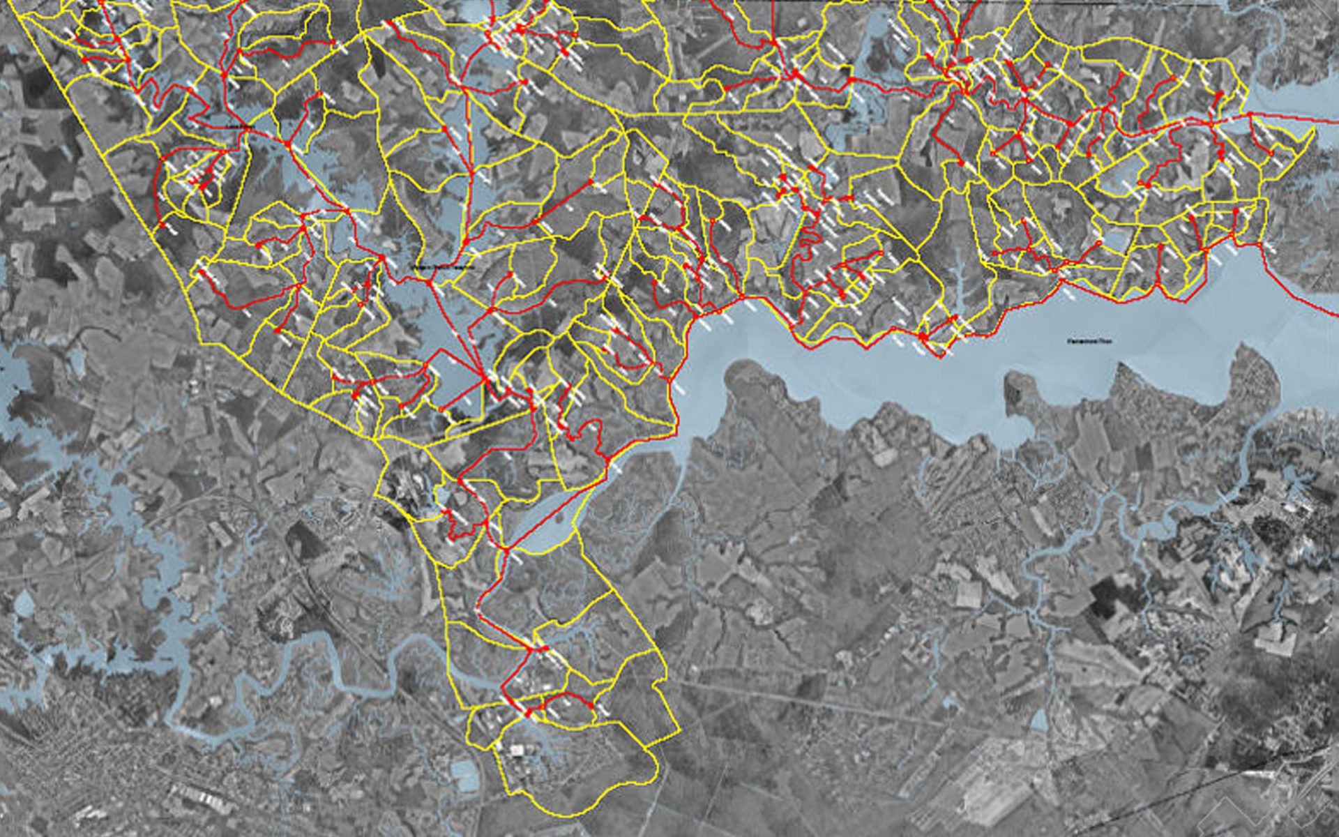
Utilizing Geographic Information Systems
To develop the GIS-based, interactive system, our team began by gathering information from a variety of sources including records, drawings, aerial photography, and discussions with city maintenance personnel. Having assembled the data for major outfalls, the team began gathering survey information, which included the establishment of horizontal and vertical controls using GPS, the determination of the horizontal location of drainage structures using the Virginia State Plane Coordinate System, and the determination of vertical locations throughout the drainage system using NAVD 88 Datum.
The team also recorded the location of an estimated 300 stormwater “major” outfalls (of which there were 265 urbanized and 35 industrial outfalls), and drainage pipe information (size, shape, and pipe invert at outfall). Lastly, an ArcGIS shape file and database was created showing the coordinate location of the outfalls along with related data including a description of the location of each outfall, the subdivision name, the drainage area in acres, and the name of the receiving body of water.
Understanding Potential Watershed Deficiencies
To gain a better understanding of potential deficiencies associated with major watersheds, the city tasked our team with performing city-side watershed delineation on the three major watersheds: the Chowan River watershed, the Great Dismal Swamp watershed, and the James River watershed. Combined, these watersheds encompass around 220 square miles. These studies leveraged multiple research techniques, including hydrologic and hydraulic analysis. Using XP-SWMM software, a model was constructed based on GIS coverages and current USGS quadrangle maps. By utilizing this map data, the locations of drainage structures serving the primary stormwater conveyances in the watershed boundaries were identified. Field identifications were also completed to evaluate and inventory the drainage structures to be modeled, and rainfall-runoff modeling and soils information was also provided to the city. After the research was completed, our civil team evaluated the results, producing a comprehensive report for deficient areas and making recommendations, including a thorough cost analysis for the proposed improvements.
