Maximize ROI with Data-Driven Infrastructure Management for Ports
 Ports and cities share many common characteristics – and face many shared challenges. The maintenance of critical infrastructure including transit networks, utilities, buildings, and more has led many municipalities to adopt an approach to asset management that is facilitated by GIS – providing city managers with the information to make better, more cost-effective decisions. Clark Nexsen’s leaders of GIS and waterfront, Pravin Mathur and Dave Pryor, have joined forces to explore how ports can successfully implement and benefit from integrating asset management with GIS.
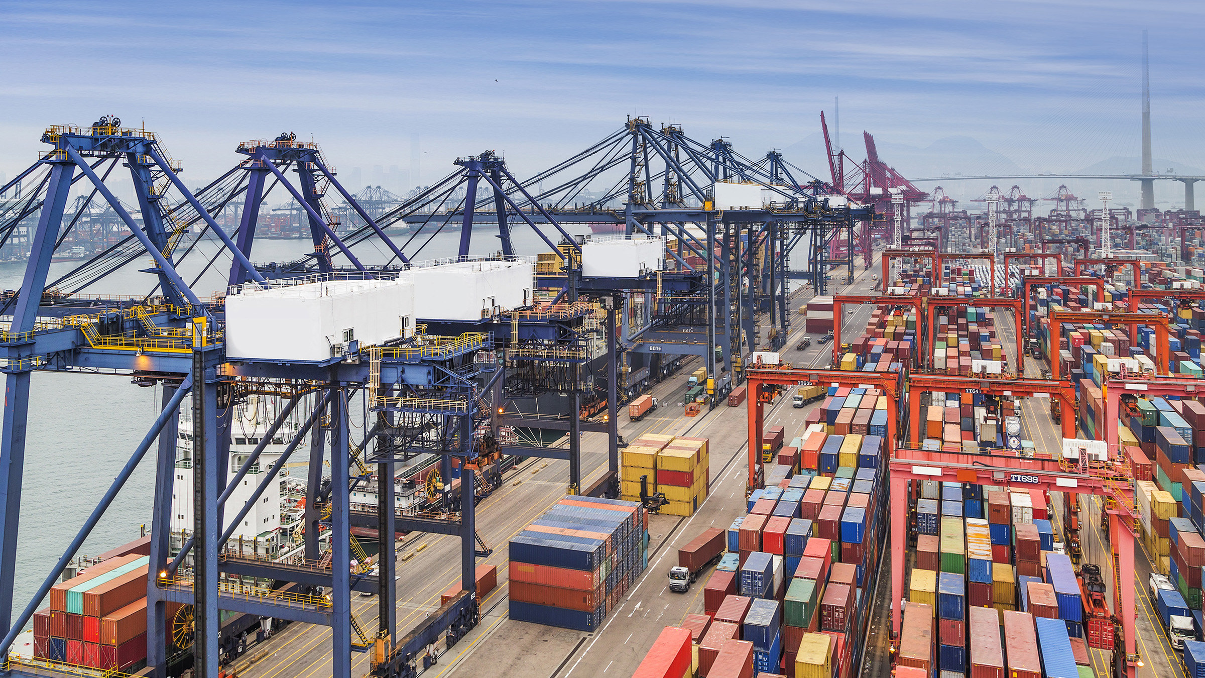
In the world of ports, adopting a GIS centric system for asset management is still a new and novel concept, but one that can offer substantial opportunity for process improvement and higher return on investment. As a living economic entity, ports are continuously in need of investments to maintain, repair, or introduce new capacity to the facility. Ideally, all of these investments translate to higher revenue as a result of better service to and function for port clients. By leveraging GIS technology, port managers are able to visually assess all aspects of their infrastructure assets, understand critical functions and adjacencies, and develop long-term plans that promote the port’s success.
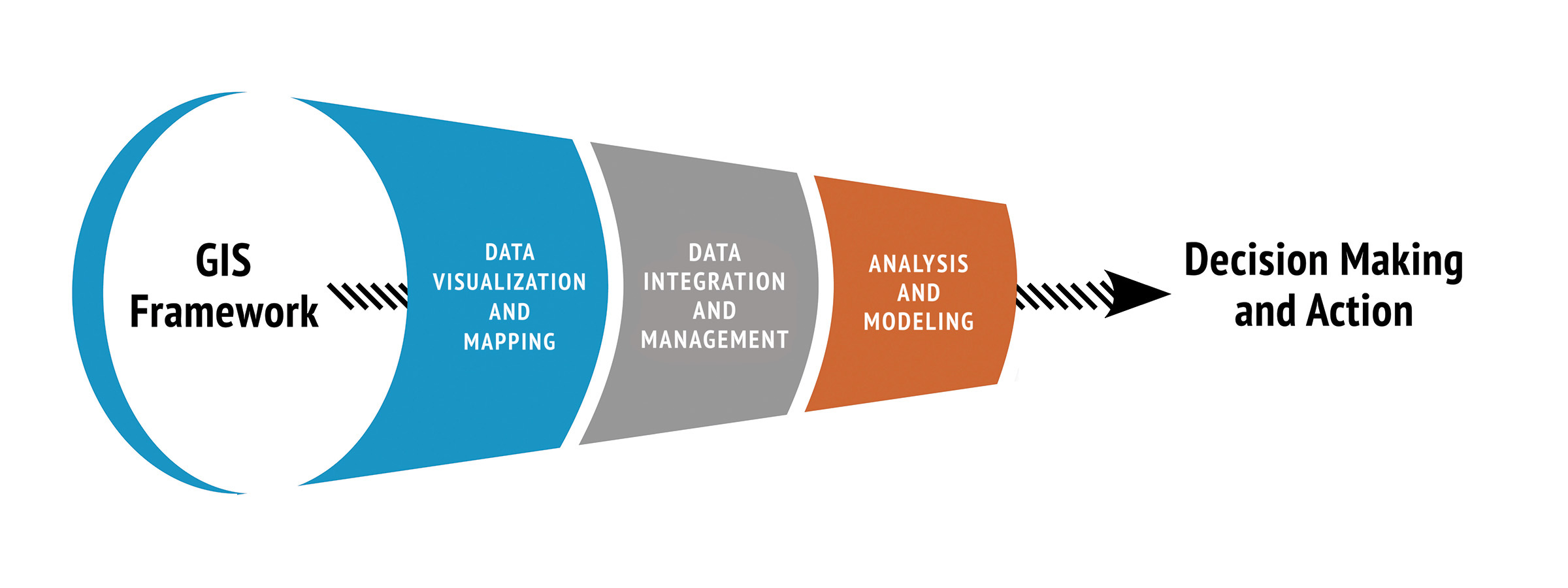
Fundamentally, integrating the functions of a port using GIS and enterprise asset management is all about maximizing return on investment. As a system of record for all spatial and other relevant information, a GIS system serves as the storehouse of all information addressing various business functions. These include critical data such as:
- Property management – specifically, where are all assets are located and how much vacant land or space is available
- Planning, design, and construction – what can be built, where it can be located, why certain structures are sited in specific locations, and what other structures or facilities could complement or hinder this new infrastructure
- Space management – identify and set aside areas or zones within a port based on use type, proximity, access, or any other business criteria; this includes transactional zones such as pick up and drop off, facilitating operations and customer service
- Transportation – determination of GIS access points that connect well with highway networks; distribution of this data to all service providers and customers
- Operations & Maintenance – together, GIS and asset management provide critical data regarding requests for service: where is the work located? How much will it cost? What resources are needed?, etc.
Data-driven infrastructure management has game-changing capacity for port managers and administrators. With GIS serving as the integrative platform to connect, analyze, and manage a wide variety of functions, port staff can gain valuable insights that inform both short- and long-term planning. For example, if there are 20 water-related issues within a day, but just one crew to respond and the average time to address each issue is an hour, the resource gap and backlog of work would be readily apparent.
 A Program – Not a Project
While the primary investment and heavy lifting reside in the initial steps to set up a GIS and asset management system, the most important driver of success is to view and treat data-driven infrastructure management as an ongoing program rather than a one-time project. By continually revisiting the GIS repository, maintaining its currency, and refining the balance of technology, processes, and end user adoption, port managers and administrators can realize the value of asset management as a roadmap to long-term ROI.
By supporting safety and risk management (the down time or non-availability of a resource or service), cost efficiency, and quality of service, an asset management system can rapidly demonstrate its tangible value in the form of ROI. Using GIS data as a foundation to locate all resources and identify key components, the relationships between all aspects of port infrastructure can be more clearly understood and informed action can be taken to enhance asset or service lifecycles. From every perspective, leveraging GIS with asset management is focused on improving port efficiency, capacity, and customer service to promote growth and economic stability.
Pravin Mathur, GISP joined Clark Nexsen in 2016 and left the firm to pursue other opportunities in 2020.
Dave Pryor, PE, previously led our Waterfront practice, specializing in marine structures, coastal engineering, shipbuilding, and management. He left the firm in 2023.
“Sustainable Infrastructure: Leveraging the Asset Management Framework Using GIS for Ports” was initially published by World Port Development Magazine.
